Precision from above.
Impact on the ground.
We map, treat and monitor landscapes with data-led drone operations built around water security, biodiversity and smarter land management.
Capabilities
From first flight to final dataset, every operation is designed around the land, the outcome and the people who need to act on it.
Survey-guided aerial treatment for invasive alien plants in steep, wet or difficult terrain—delivered with repeatable flight parameters, controlled spray windows and minimal ground disturbance.
Invasive plantsAerial applicationHard terrain
High-resolution corridor mapping, orthomosaics, terrain models and geospatial records that turn complex sites into clear, measurable operational plans.
1–2 cm GSDTerrain modelsKML / GIS
Machine-learning-assisted target identification, multispectral insight and repeat monitoring to prioritise work, measure response and guide follow-up treatment.
Machine learningMonitoringPlant health
Accurate 3D site models, stockpile measurements and progress documentation for construction, mining and land-management decisions.
3D modelsVolumesProgress
Drone-assisted fence-line clearing and firebreak maintenance for clearer boundaries, easier inspection and stronger fire readiness.
Fence linesFirebreaksRisk reduction
DamIt™ non-toxic aerial sealing for targeted leak treatment without draining—minimising disruption to livestock and farm operations.
DamIt™Water retentionLow disruption
Aerial re-seeding and targeted spreading to accelerate pasture recovery, restore disturbed land and improve grazing quality.
Re-seedingPasture recoveryRestoration
Fast, safe visual inspections for wind turbines and hard-to-reach infrastructure—supporting earlier maintenance decisions and less downtime.
Wind turbinesInspectionAsset records
Selected customers & project partners
Trusted across conservation, research, local government and private land.


How we work
Capture the site at operational resolution and establish a defensible baseline.
Translate terrain, species and risk into a practical treatment or survey plan.
Fly precisely, work efficiently and document every operation as it happens.
Return to measure results, identify gaps and inform the next intervention.
Operational intelligence
Flight paths, treatment blocks, imagery and field observations combine into a clear project record—ready for reporting, review and future planning.
Why it matters
Restore catchment function by treating thirsty invasive plants at landscape scale.
Give indigenous vegetation the space and time it needs to recover.
Reduce invasive biomass and the fuel loads that intensify wildfire risk.
Case study · Kammanassie River
An 18-month, multi-phase programme targeting Acacia mearnsii across the Kammanassie River corridor in the Western Cape. Earth Drones combined high-resolution survey, machine-learning-assisted target mapping, precision aerial application and post-treatment monitoring in steep and access-constrained riparian terrain.
Black Wattle occurred as fragmented and locally dense infestations along a long perennial river corridor below the Kammanassie Nature Reserve. Uneven terrain, restricted ground access and proximity to agricultural land required mapped targets, controlled flight planning and repeatable treatment records.
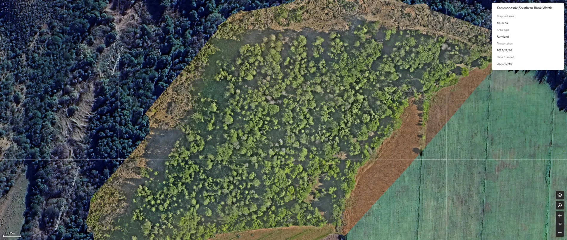
Survey data was converted into treatment polygons so application could be limited to identified canopy. The programme was delivered in phases, allowing the team to return after canopy response was visible and focus Phase 2 on survivors and coppice regrowth.
DJI Mavic 3 Enterprise capture at approximately 1–2 cm ground sampling distance.
Orthomosaics and ML-assisted classification used to define target canopy and flight blocks.
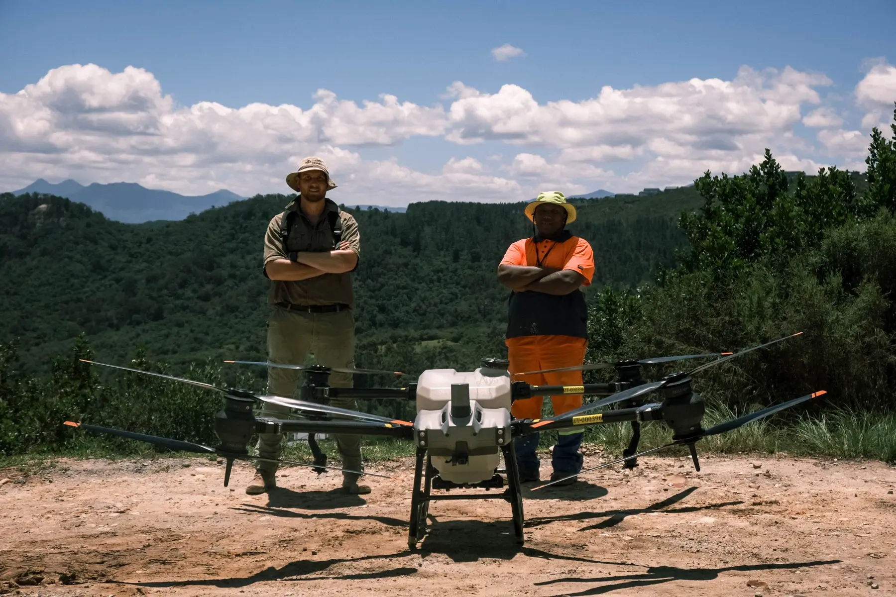
Low-altitude precision application with DJI Agras T40 ZT-000396 across mapped polygons.
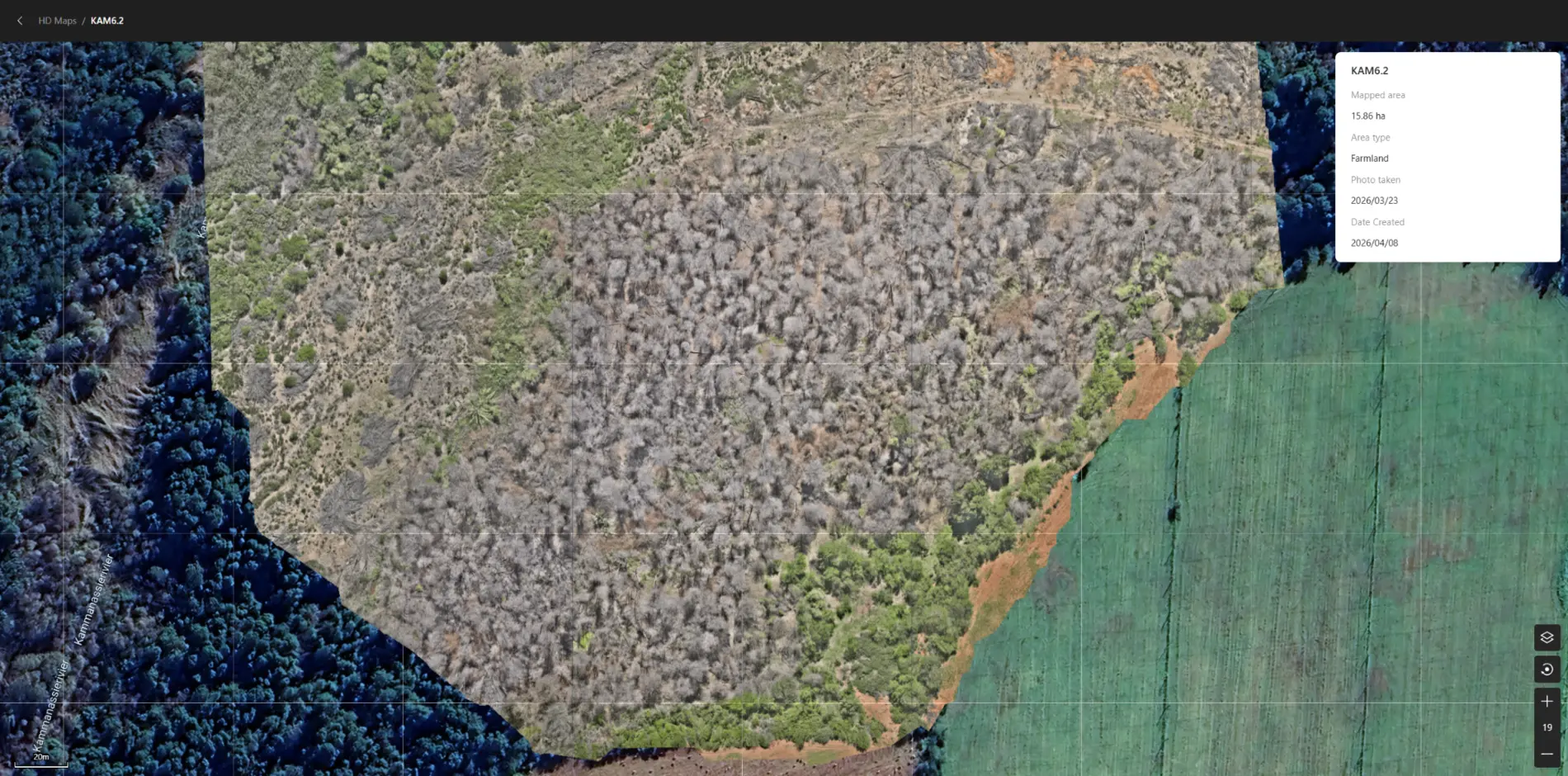
Follow-up mapping 8–9 months after Phase 1 identified survivors and informed mop-up work.
Recorded production
total mixed spray volume across 27.90 ha of mapped treatment area
Outcome interpretation
Phase 1 efficacy was reported at more than 90% during follow-up assessment. The result indicates strong initial control, while also confirming that systematic surveillance and targeted follow-up remain necessary because survivors, coppice and the existing seed bank can re-establish the infestation.
Project collaboration
SKWGV · Western Cape Department of Agriculture · BOCMA · Apex Agri · Hermès · Earth Drones
Results shown are operational monitoring outcomes from the project record. They should not be interpreted as an independently audited ecological or hydrological impact study.
01Mapped infestation and treatment planning · 16 Dec 2025
02Post-treatment monitoring and survivor identification · 23 Mar 2026
About Earth Drones
Earth Drones is a South African environmental and geospatial operations company based in the Klein Karoo.
Led by David Rogers, our field team combines licensed aerial application, commercial drone operations, conservation experience and practical GIS workflows. We work where conventional access is slow, costly or unsafe—supporting catchment restoration, precision agriculture, surveying and environmental monitoring.
SACAA licensedAerial application PCOWeed control PCO
Field operations
From farms and dams to mountain catchments, Earth Drones combines practical field access with the aerial tools needed to see, treat and document difficult terrain.
Start a conversation
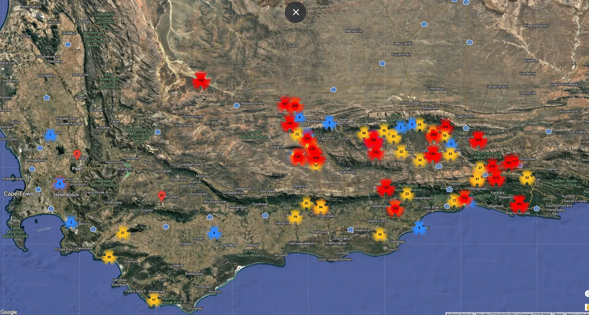
Find your farm on the satellite map and draw the area you want us to assess. We’ll calculate the hectares and include the boundary in a clear project brief.
01 · Map the site
Scroll to zoom. Choose the polygon tool, click around the work area, then click the first point to finish.
02 · Tell us about the work
Map search is provided by OpenStreetMap. Satellite imagery, roads and place labels by Esri.